![SolutionCenters (Americas) [Beta]](https://solutioncenters.org/wp-content/uploads/2026/02/SCUS-Lg-Copy-2.png)
Nebraska


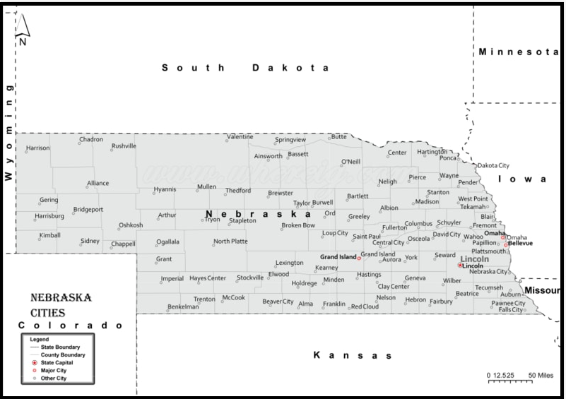
Cities of Nebraska
| Rank | Name | Population | Density (mi²) | Area (mi²) |
|---|---|---|---|---|
| 1 | Omaha | 479,978 | 3,405 | 140.98 |
| 2 | Lincoln | 293,446 | 3,050 | 96.22 |
| 3 | Bellevue | 53,644 | 3,237 | 16.57 |
| 4 | Grand Island | 51,363 | 1,727 | 29.75 |
| 5 | Kearney | 34,411 | 2,380 | 14.46 |
| 6 | Fremont | 26,207 | 2,516 | 10.42 |
| 7 | Hastings | 24,428 | 1,674 | 14.59 |
| 8 | Norfolk | 24,323 | 2,144 | 11.35 |
| 9 | Columbus | 23,792 | 2,258 | 10.54 |
| 10 | North Platte | 23,303 | 1,761 | 13.24 |
| 11 | Papillion | 20,475 | 2,074 | 9.87 |
| 12 | La Vista | 17,312 | 3,188 | 5.43 |
| 13 | Scottsbluff | 14,278 | 2,152 | 6.63 |
| 14 | South Sioux City | 12,849 | 2,004 | 6.41 |
| 15 | Beatrice | 12,299 | 1,309 | 9.39 |
| 16 | Chalco | 10,952 | 3,888 | 2.82 |
| 17 | Lexington | 10,051 | 2,234 | 4.5 |
| 18 | Alliance | 8,170 | 1,640 | 4.98 |
| 19 | Gering | 7,978 | 1,855 | 4.3 |
| 20 | Blair | 7,972 | 1,447 | 5.51 |
| 21 | York | 7,832 | 1,211 | 6.46 |
| 22 | McCook | 7,580 | 1,404 | 5.4 |
| 23 | Nebraska City | 7,322 | 1,472 | 4.97 |
| 24 | Seward | 7,240 | 1,625 | 4.46 |
| 25 | Ralston | 7,219 | 4,378 | 1.65 |
| 26 | Crete | 6,873 | 2,081 | 3.3 |
| 27 | Plattsmouth | 6,367 | 1,922 | 3.31 |
| 28 | Schuyler | 6,327 | 2,324 | 2.72 |
| 29 | Wayne | 5,840 | 2,077 | 2.81 |
| 30 | Sidney | 5,635 | 753 | 7.49 |
| 31 | Holdrege | 5,406 | 1,277 | 4.23 |
| 32 | Chadron | 5,256 | 1,347 | 3.9 |
| 33 | Gretna | 5,080 | 2,087 | 2.43 |
| 34 | Offutt AFB | 5,048 | 1,273 | 3.96 |
| 35 | Wahoo | 4,626 | 1,577 | 2.93 |
| 36 | Aurora | 4,593 | 1,508 | 3.04 |
| 37 | Ogallala | 4,517 | 911 | 4.96 |
| 38 | Waverly | 4,339 | 1,823 | 2.38 |
| 39 | Falls City | 4,045 | 1,210 | 3.34 |
| 40 | Cozad | 3,651 | 1,396 | 2.62 |
| 41 | Fairbury | 3,564 | 1,411 | 2.53 |
| 42 | O’Neill | 3,519 | 1,475 | 2.38 |
| 43 | Broken Bow | 3,439 | 1,761 | 1.95 |
| 44 | Gothenburg | 3,398 | 948 | 3.58 |
| 45 | Auburn | 3,348 | 1,535 | 2.18 |
| 46 | West Point | 3,213 | 1,161 | 2.77 |
| 47 | Valley | 2,982 | 624 | 4.78 |
| 48 | Minden | 2,922 | 1,326 | 2.2 |
| 49 | Central City | 2,880 | 1,240 | 2.32 |
| 50 | David City | 2,842 | 1,650 | 1.72 |
| 51 | Ashland | 2,764 | 2,513 | 1.1 |
| 52 | Valentine | 2,626 | 1,140 | 2.3 |
| 53 | Hickman | 2,529 | 3,018 | 0.84 |
| 54 | Kimball | 2,447 | 1,182 | 2.07 |
| 55 | Madison | 2,438 | 2,075 | 1.18 |
| 56 | St. Paul | 2,313 | 1,952 | 1.19 |
| 57 | Milford | 2,086 | 2,566 | 0.81 |
| 58 | Imperial | 2,055 | 679 | 3.02 |
| 59 | Geneva | 2,038 | 901 | 2.26 |
| 60 | Ord | 2,036 | 969 | 2.1 |
| 61 | Syracuse | 1,938 | 1,518 | 1.28 |
| 62 | Dakota City | 1,861 | 1,292 | 1.44 |
| 63 | Gibbon | 1,857 | 2,137 | 0.87 |
| 64 | Wilber | 1,814 | 2,013 | 0.9 |
| 65 | Superior | 1,755 | 931 | 1.89 |
| 66 | Pierce | 1,734 | 1,914 | 0.91 |
| 67 | Tekamah | 1,706 | 1,085 | 1.57 |
| 68 | Springfield | 1,672 | 2,256 | 0.74 |
| 69 | Ainsworth | 1,618 | 1,612 | 1 |
| 70 | Mitchell | 1,595 | 2,377 | 0.67 |
| 71 | Woodland Park | 1,588 | 1,015 | 1.56 |
| 72 | Albion | 1,557 | 1,503 | 1.04 |
| 73 | Gordon | 1,553 | 1,668 | 0.93 |
| 74 | Tecumseh | 1,538 | 1,018 | 1.51 |
| 75 | Bennington | 1,519 | 1,821 | 0.83 |
| 76 | Neligh | 1,489 | 1,018 | 1.46 |
| 77 | Stanton | 1,480 | 851 | 1.74 |
| 78 | Bridgeport | 1,470 | 1,280 | 1.15 |
| 79 | Hartington | 1,436 | 1,433 | 1 |
| 80 | Sutton | 1,434 | 824 | 1.74 |
| 81 | Hebron | 1,410 | 1,003 | 1.41 |
| 82 | Yutan | 1,356 | 2,362 | 0.57 |
| 83 | Ravenna | 1,352 | 814 | 1.66 |
| 84 | Wakefield | 1,333 | 1,255 | 1.06 |
| 85 | Arlington | 1,331 | 2,226 | 0.6 |
| 86 | Wood River | 1,328 | 1,673 | 0.79 |
| 87 | Wymore | 1,324 | 707 | 1.87 |
| 88 | Louisville | 1,320 | 2,034 | 0.65 |
| 89 | Sutherland | 1,292 | 993 | 1.3 |
| 90 | Fullerton | 1,220 | 936 | 1.3 |
| 91 | Atkinson | 1,213 | 741 | 1.64 |
| 92 | North Bend | 1,195 | 1,069 | 1.12 |
| 93 | Plainview | 1,188 | 1,098 | 1.08 |
| 94 | Battle Creek | 1,169 | 1,223 | 0.96 |
| 95 | Oakland | 1,169 | 1,656 | 0.71 |
| 96 | Terrytown | 1,157 | 2,446 | 0.47 |
| 97 | Wisner | 1,154 | 1,022 | 1.13 |
| 98 | Burwell | 1,147 | 1,106 | 1.04 |
| 99 | Alma | 1,139 | 990 | 1.15 |
| 100 | Stromsburg | 1,137 | 1,124 | 1.01 |
| 101 | Eagle | 1,110 | 3,217 | 0.34 |
| 102 | Pender | 1,108 | 1,569 | 0.71 |
| 103 | Weeping Water | 1,103 | 1,141 | 0.97 |
| 104 | Grant | 1,099 | 1,433 | 0.77 |
| 105 | Shelton | 1,067 | 1,456 | 0.73 |
| 106 | Creighton | 1,066 | 881 | 1.21 |
| 107 | Bayard | 1,052 | 1,514 | 0.69 |
| 108 | Bennet | 1,023 | 1,964 | 0.52 |
| 109 | Fort Calhoun | 994 | 1,515 | 0.66 |
| 110 | Macy | 988 | 619 | 1.59 |
| 111 | Arapahoe | 976 | 983 | 0.99 |
| 112 | Genoa | 974 | 1,228 | 0.79 |
| 113 | Henderson | 963 | 1,613 | 0.6 |
| 114 | Cambridge | 962 | 720 | 1.34 |
| 115 | Harvard | 960 | 1,488 | 0.65 |
| 116 | Elm Creek | 957 | 1,377 | 0.69 |
| 117 | Kenesaw | 950 | 903 | 1.05 |
| 118 | Friend | 943 | 1,140 | 0.83 |
| 119 | Loup City | 937 | 995 | 0.94 |
| 120 | Bloomfield | 928 | 1,137 | 0.82 |
| 121 | Tilden | 918 | 1,183 | 0.78 |
| 122 | Waterloo | 915 | 1,419 | 0.65 |
| 123 | Laurel | 906 | 768 | 1.18 |
| 124 | Curtis | 905 | 754 | 1.2 |
| 125 | Ceresco | 903 | 2,135 | 0.42 |
| 126 | Crawford | 900 | 765 | 1.18 |
| 127 | Rushville | 895 | 778 | 1.15 |
| 128 | Ponca | 894 | 1,230 | 0.73 |
| 129 | Randolph | 880 | 934 | 0.94 |
| 130 | Red Cloud | 878 | 855 | 1.03 |
| 131 | Morrill | 875 | 1,560 | 0.56 |
| 132 | Blue Hill | 862 | 1,168 | 0.74 |
| 133 | Franklin | 852 | 1,264 | 0.67 |
| 134 | Hooper | 852 | 859 | 0.99 |
| 135 | Doniphan | 832 | 1,638 | 0.51 |
| 136 | Osceola | 825 | 895 | 0.92 |
| 137 | Chappell | 823 | 1,785 | 0.46 |
| 138 | Utica | 823 | 1,172 | 0.7 |
| 139 | Juniata | 821 | 1,231 | 0.67 |
| 140 | Pawnee City | 820 | 680 | 1.21 |
| 141 | Humphrey | 815 | 1,646 | 0.49 |
| 142 | Cairo | 794 | 833 | 0.95 |
| 143 | Lyons | 789 | 1,155 | 0.68 |
| 144 | Scribner | 787 | 1,232 | 0.64 |
| 145 | Emerson | 786 | 1,662 | 0.47 |
| 146 | Humboldt | 784 | 588 | 1.33 |
| 147 | Walthill | 778 | 1,818 | 0.43 |
| 148 | Hemingford | 777 | 1,143 | 0.68 |
| 149 | Minatare | 773 | 2,034 | 0.38 |
| 150 | Winnebago | 769 | 3,807 | 0.2 |
| 151 | Peru | 749 | 1,424 | 0.53 |
| 152 | Axtell | 745 | 935 | 0.8 |
| 153 | Osmond | 745 | 1,606 | 0.46 |
| 154 | Deshler | 737 | 1,451 | 0.51 |
| 155 | Oxford | 727 | 799 | 0.91 |
| 156 | Benkelman | 726 | 993 | 0.73 |
| 157 | Clay Center | 726 | 905 | 0.8 |
| 158 | Bertrand | 725 | 1,309 | 0.55 |
| 159 | Oshkosh | 721 | 1,078 | 0.67 |
| 160 | Shelby | 699 | 1,244 | 0.56 |
| 161 | Newman Grove | 691 | 1,268 | 0.55 |
| 162 | Firth | 685 | 2,027 | 0.34 |
| 163 | Elwood | 683 | 1,319 | 0.52 |
| 164 | Alda | 670 | 1,186 | 0.56 |
| 165 | Elmwood | 667 | 1,779 | 0.38 |
| 166 | Beemer | 659 | 1,648 | 0.4 |
| 167 | St. Edward | 653 | 992 | 0.66 |
| 168 | Crofton | 651 | 1,017 | 0.64 |
| 169 | Hershey | 646 | 847 | 0.76 |
| 170 | Clarkson | 629 | 795 | 0.79 |
| 171 | Adams | 627 | 1,054 | 0.59 |
| 172 | Elgin | 613 | 842 | 0.73 |
| 173 | Greenwood | 599 | 1,457 | 0.41 |
| 174 | Mead | 593 | 974 | 0.61 |
| 175 | Dodge | 591 | 1,496 | 0.4 |
| 176 | Beaver City | 583 | 589 | 0.99 |
| 177 | Cedar Bluffs | 581 | 1,501 | 0.39 |
| 178 | Stuart | 574 | 420 | 1.37 |
| 179 | Palmyra | 569 | 1,674 | 0.34 |
| 180 | Dorchester | 568 | 1,193 | 0.48 |
| 181 | Overton | 561 | 1,039 | 0.54 |
| 182 | Arnold | 560 | 836 | 0.67 |
| 183 | Howells | 556 | 965 | 0.58 |
| 184 | Callaway | 554 | 1,473 | 0.38 |
| 185 | Hay Springs | 554 | 794 | 0.7 |
| 186 | Indianola | 550 | 441 | 1.25 |
| 187 | Glenwood | 549 | 229 | 2.4 |
| 188 | Wauneta | 546 | 563 | 0.97 |
| 189 | Valparaiso | 545 | 968 | 0.56 |
| 190 | Culbertson | 541 | 646 | 0.84 |
| 191 | Bassett | 538 | 1,212 | 0.44 |
| 192 | Trenton | 523 | 905 | 0.58 |
| 193 | Homer | 519 | 1,403 | 0.37 |
| 194 | Wausa | 513 | 979 | 0.52 |
| 195 | Exeter | 510 | 806 | 0.63 |
| 196 | Verdigre | 505 | 922 | 0.55 |
| 197 | Fairmont | 501 | 615 | 0.81 |
| 198 | Sargent | 500 | 460 | 1.09 |
| 199 | Boys Town | 498 | 379 | 1.31 |
| 200 | Murray | 491 | 1,313 | 0.37 |
| 201 | De Witt | 488 | 1,170 | 0.42 |
| 202 | Paxton | 486 | 471 | 1.03 |
| 203 | Cortland | 470 | 1,787 | 0.26 |
| 204 | Mullen | 469 | 880 | 0.53 |
| 205 | Palmer | 469 | 998 | 0.47 |
| 206 | Decatur | 459 | 450 | 1.02 |
| 207 | Coleridge | 456 | 892 | 0.51 |
| 208 | Bancroft | 454 | 1,240 | 0.37 |
| 209 | Sterling | 449 | 1,103 | 0.41 |
| 210 | Edgar | 448 | 567 | 0.79 |
| 211 | Hampton | 437 | 1,263 | 0.35 |
| 212 | Spalding | 436 | 1,358 | 0.32 |
| 213 | McCool Junction | 433 | 898 | 0.48 |
| 214 | Nelson | 431 | 528 | 0.82 |
| 215 | Greeley | 428 | 680 | 0.63 |
| 216 | Bellwood | 426 | 1,790 | 0.24 |
| 217 | Ansley | 425 | 592 | 0.72 |
| 218 | Brady | 422 | 1,287 | 0.33 |
| 219 | Beaver Crossing | 418 | 638 | 0.66 |
| 220 | Roca | 416 | 2,993 | 0.14 |
| 221 | Cedar Creek | 414 | 725 | 0.57 |
| 222 | Malcolm | 408 | 2,776 | 0.15 |
| 223 | Leigh | 407 | 679 | 0.6 |
| 224 | Spencer | 404 | 775 | 0.52 |
| 225 | Clearwater | 400 | 1,090 | 0.37 |
| 226 | Winside | 395 | 1,513 | 0.26 |
| 227 | Giltner | 389 | 1,005 | 0.39 |
| 228 | Loomis | 384 | 1,167 | 0.33 |
| 229 | Eustis | 379 | 896 | 0.42 |
| 230 | Duncan | 377 | 908 | 0.41 |
| 231 | Fairfield | 371 | 976 | 0.38 |
| 232 | Nickerson | 371 | 514 | 0.72 |
| 233 | Lakeview | 370 | 607 | 0.61 |
| 234 | Pleasanton | 369 | 1,092 | 0.34 |
| 235 | Ewing | 368 | 1,239 | 0.3 |
| 236 | Kennard | 368 | 825 | 0.45 |
| 237 | Big Springs | 367 | 1,161 | 0.32 |
| 238 | Plymouth | 367 | 828 | 0.44 |
| 239 | Orleans | 363 | 605 | 0.6 |
| 240 | Silver Creek | 359 | 1,305 | 0.28 |
| 241 | Merna | 357 | 666 | 0.54 |
| 242 | Cedar Rapids | 354 | 989 | 0.36 |
| 243 | Newcastle | 352 | 1,041 | 0.34 |
| 244 | Hildreth | 350 | 964 | 0.36 |
| 245 | Rising City | 350 | 612 | 0.57 |
| 246 | Pilger | 348 | 1,180 | 0.29 |
| 247 | Orchard | 343 | 764 | 0.45 |
| 248 | Santee | 340 | 603 | 0.56 |
| 249 | Wilcox | 339 | 629 | 0.54 |
| 250 | Clarks | 338 | 1,130 | 0.3 |
| 251 | Platte Center | 338 | 1,076 | 0.31 |
| 252 | Allen | 337 | 906 | 0.37 |
| 253 | Wallace | 334 | 470 | 0.71 |
| 254 | Niobrara | 332 | 1,489 | 0.22 |
| 255 | Weston | 332 | 456 | 0.73 |
| 256 | Johnson | 330 | 1,500 | 0.22 |
| 257 | Unadilla | 322 | 1,049 | 0.31 |
| 258 | Blue Springs | 321 | 985 | 0.33 |
| 259 | Prague | 321 | 419 | 0.77 |
| 260 | Inglewood | 320 | 1,333 | 0.24 |
| 261 | Palisade | 318 | 896 | 0.35 |
| 262 | Hadar | 317 | 801 | 0.4 |
| 263 | Stratton | 316 | 733 | 0.43 |
| 264 | Lyman | 315 | 804 | 0.39 |
| 265 | Hallam | 312 | 1,451 | 0.21 |
| 266 | Dannebrog | 309 | 1,010 | 0.31 |
| 267 | Shickley | 309 | 847 | 0.36 |
| 268 | Brainard | 308 | 931 | 0.33 |
| 269 | Hoskins | 307 | 994 | 0.31 |
| 270 | Petersburg | 306 | 818 | 0.37 |
| 271 | Brule | 305 | 987 | 0.31 |
| 272 | Phillips | 304 | 1,038 | 0.29 |
| 273 | Arcadia | 303 | 531 | 0.57 |
| 274 | Polk | 297 | 607 | 0.49 |
| 275 | Maxwell | 295 | 1,175 | 0.25 |
| 276 | Stapleton | 295 | 865 | 0.34 |
| 277 | Cook | 294 | 1,699 | 0.17 |
| 278 | Glenvil | 292 | 1,688 | 0.17 |
| 279 | Chapman | 291 | 560 | 0.52 |
| 280 | North Loup | 291 | 711 | 0.41 |
| 281 | Oakdale | 291 | 652 | 0.45 |
| 282 | Butte | 289 | 700 | 0.41 |
| 283 | Campbell | 289 | 693 | 0.42 |
| 284 | Odell | 287 | 1,091 | 0.26 |
| 285 | Yankee Hill | 286 | 100 | 2.85 |
| 286 | Scotia | 285 | 588 | 0.48 |
| 287 | Snyder | 285 | 821 | 0.35 |
| 288 | Davenport | 283 | 928 | 0.3 |
| 289 | Meadow Grove | 283 | 434 | 0.65 |
| 290 | Long Pine | 280 | 1,609 | 0.17 |
| 291 | Monroe | 280 | 484 | 0.58 |
| 292 | Herman | 273 | 658 | 0.41 |
| 293 | Lawrence | 273 | 1,909 | 0.14 |
| 294 | Lindsay | 272 | 747 | 0.36 |
| 295 | Bartley | 271 | 289 | 0.94 |
| 296 | Panama | 270 | 951 | 0.28 |
| 297 | Bruning | 267 | 937 | 0.28 |
| 298 | Potter | 266 | 185 | 1.44 |
| 299 | Roseland | 265 | 960 | 0.28 |
| 300 | Bradshaw | 262 | 787 | 0.33 |
| 301 | Milligan | 258 | 1,024 | 0.25 |
| 302 | Diller | 256 | 611 | 0.42 |
| 303 | Amherst | 255 | 402 | 0.63 |
| 304 | Maywood | 255 | 1,170 | 0.22 |
| 305 | Avoca | 254 | 370 | 0.69 |
| 306 | Chambers | 254 | 250 | 1.02 |
| 307 | Wolbach | 254 | 1,939 | 0.13 |
| 308 | Murdock | 253 | 431 | 0.59 |
| 309 | Table Rock | 253 | 1,961 | 0.13 |
| 310 | Dalton | 252 | 733 | 0.34 |
| 311 | Lodgepole | 249 | 522 | 0.48 |
| 312 | Dix | 248 | 1,127 | 0.22 |
| 313 | Union | 245 | 1,178 | 0.21 |
| 314 | Litchfield | 243 | 799 | 0.3 |
| 315 | Marquette | 241 | 1,470 | 0.16 |
| 316 | Talmage | 241 | 1,164 | 0.21 |
| 317 | Holstein | 236 | 355 | 0.66 |
| 318 | Springview | 236 | 933 | 0.25 |
| 319 | Madrid | 233 | 206 | 1.13 |
| 320 | Woodland Hills | 232 | 648 | 0.36 |
| 321 | Waco | 230 | 473 | 0.49 |
| 322 | Western | 230 | 1,004 | 0.23 |
| 323 | Hubbard | 228 | 874 | 0.26 |
| 324 | Staplehurst | 228 | 1,824 | 0.13 |
| 325 | Taylor | 228 | 1,373 | 0.17 |
| 326 | Elba | 227 | 619 | 0.37 |
| 327 | Thedford | 223 | 929 | 0.24 |
| 328 | Benedict | 222 | 1,156 | 0.19 |
| 329 | Chester | 220 | 982 | 0.22 |
| 330 | Clatonia | 220 | 794 | 0.28 |
| 331 | Uehling | 220 | 375 | 0.59 |
| 332 | Harrison | 215 | 703 | 0.31 |
| 333 | Nehawka | 214 | 943 | 0.23 |
| 334 | Bladen | 213 | 722 | 0.29 |
| 335 | Sumner | 213 | 593 | 0.36 |
| 336 | Lynch | 212 | 397 | 0.53 |
| 337 | Denton | 210 | 1,721 | 0.12 |
| 338 | Carroll | 209 | 1,244 | 0.17 |
| 339 | Garland | 209 | 1,375 | 0.15 |
| 340 | Hayes Center | 207 | 767 | 0.27 |
| 341 | Gresham | 206 | 766 | 0.27 |
| 342 | Creston | 203 | 451 | 0.45 |
| 343 | Jackson | 203 | 981 | 0.21 |
| 344 | Pleasant Dale | 202 | 1,788 | 0.11 |
| 345 | Guide Rock | 196 | 455 | 0.43 |
| 346 | Trumbull | 196 | 394 | 0.5 |
| 347 | Holbrook | 194 | 1,205 | 0.16 |
| 348 | Dunbar | 193 | 839 | 0.23 |
| 349 | Pickrell | 191 | 1,785 | 0.11 |
| 350 | Dwight | 189 | 1,443 | 0.13 |
| 351 | Lewellen | 189 | 511 | 0.37 |
| 352 | Raymond | 189 | 771 | 0.24 |
| 353 | Craig | 185 | 261 | 0.71 |
| 354 | Howard City Boelus | 185 | 649 | 0.28 |
| 355 | Ashton | 183 | 995 | 0.18 |
| 356 | Funk | 183 | 696 | 0.26 |
| 357 | Wynot | 183 | 309 | 0.59 |
| 358 | Otoe | 182 | 1,145 | 0.16 |
| 359 | Douglas | 179 | 50 | 3.56 |
| 360 | Riverdale | 179 | 678 | 0.26 |
| 361 | Walton | 179 | 814 | 0.22 |
| 362 | Bee | 176 | 2,588 | 0.07 |
| 363 | Manley | 176 | 704 | 0.25 |
| 364 | Alexandria | 173 | 428 | 0.4 |
| 365 | Gurley | 171 | 914 | 0.19 |
| 366 | Stamford | 169 | 357 | 0.47 |
| 367 | Mason City | 167 | 352 | 0.47 |
| 368 | St. Libory | 166 | 500 | 0.33 |
| 369 | Hyannis | 164 | 315 | 0.52 |
| 370 | Daykin | 161 | 239 | 0.67 |
| 371 | Farnam | 161 | 982 | 0.16 |
| 372 | Rosalie | 160 | 816 | 0.2 |
| 373 | Ulysses | 159 | 791 | 0.2 |
| 374 | La Platte | 158 | 252 | 0.63 |
| 375 | Rulo | 158 | 560 | 0.28 |
| 376 | Goehner | 156 | 658 | 0.24 |
| 377 | Venango | 156 | 206 | 0.76 |
| 378 | Verdon | 156 | 897 | 0.17 |
| 379 | Washington | 155 | 756 | 0.2 |
| 380 | Page | 154 | 631 | 0.24 |
| 381 | Sprague | 153 | 1,500 | 0.1 |
| 382 | Davey | 152 | 468 | 0.33 |
| 383 | Hordville | 152 | 569 | 0.27 |
| 384 | Republican City | 152 | 987 | 0.15 |
| 385 | Concord | 148 | 836 | 0.18 |
| 386 | Ithaca | 148 | 635 | 0.23 |
| 387 | Morse Bluff | 148 | 1,121 | 0.13 |
| 388 | Cody | 147 | 143 | 1.03 |
| 389 | Hardy | 142 | 700 | 0.2 |
| 390 | Nemaha | 142 | 469 | 0.3 |
| 391 | Oconto | 142 | 234 | 0.61 |
| 392 | Stella | 141 | 797 | 0.18 |
| 393 | Anselmo | 140 | 526 | 0.27 |
| 394 | Atlanta | 138 | 597 | 0.23 |
| 395 | Du Bois | 137 | 302 | 0.45 |
| 396 | Shubert | 136 | 648 | 0.21 |
| 397 | Alvo | 135 | 1,350 | 0.1 |
| 398 | Dawson | 133 | 624 | 0.21 |
| 399 | Brownville | 132 | 222 | 0.59 |
| 400 | Brunswick | 132 | 202 | 0.65 |
| 401 | Cordova | 130 | 316 | 0.41 |
| 402 | Thurston | 130 | 1,121 | 0.12 |
| 403 | Upland | 130 | 522 | 0.25 |
| 404 | Fordyce | 129 | 890 | 0.14 |
| 405 | Haigler | 128 | 527 | 0.24 |
| 406 | Merriman | 125 | 330 | 0.38 |
| 407 | Miller | 125 | 122 | 1.03 |
| 408 | Filley | 124 | 1,138 | 0.11 |
| 409 | Endicott | 123 | 269 | 0.46 |
| 410 | Ayr | 122 | 504 | 0.24 |
| 411 | Bushnell | 120 | 420 | 0.29 |
| 412 | Inman | 120 | 526 | 0.23 |
| 413 | Edison | 119 | 1,725 | 0.07 |
| 414 | Leshara | 119 | 447 | 0.27 |
| 415 | Arthur | 118 | 738 | 0.16 |
| 416 | Octavia | 118 | 381 | 0.31 |
| 417 | Broadwater | 117 | 745 | 0.16 |
| 418 | Belgrade | 114 | 838 | 0.14 |
| 419 | Grafton | 114 | 327 | 0.35 |
| 420 | Malmo | 114 | 610 | 0.19 |
| 421 | Barneston | 113 | 463 | 0.24 |
| 422 | Farwell | 111 | 266 | 0.42 |
| 423 | Ruskin | 111 | 642 | 0.17 |
| 424 | Bartlett | 110 | 351 | 0.31 |
| 425 | Colon | 110 | 840 | 0.13 |
| 426 | Jansen | 110 | 775 | 0.14 |
| 427 | Loretto | 109 | 694 | 0.16 |
| 428 | Roscoe | 109 | 388 | 0.28 |
| 429 | Belden | 107 | 718 | 0.15 |
| 430 | Melbeta | 106 | 1,218 | 0.09 |
| 431 | Memphis | 106 | 1,104 | 0.1 |
| 432 | Sarben | 105 | 669 | 0.16 |
| 433 | Belmar | 104 | 167 | 0.62 |
| 434 | Salem | 104 | 23 | 4.58 |
| 435 | Elsie | 103 | 69 | 1.49 |
| 436 | Tobias | 103 | 393 | 0.26 |
| 437 | Wann | 103 | 595 | 0.17 |
| 438 | Brock | 102 | 761 | 0.13 |
| 439 | Lemoyne | 102 | 410 | 0.25 |
| 440 | Ohiowa | 102 | 200 | 0.51 |
| 441 | South Bend | 102 | 326 | 0.31 |
| 442 | Winslow | 101 | 697 | 0.14 |
| 443 | Naponee | 100 | 87 | 1.15 |
| 444 | Overland | 100 | 433 | 0.23 |
| 445 | McGrew | 99 | 262 | 0.38 |
| 446 | Henry | 98 | 576 | 0.17 |
| 447 | Rogers | 98 | 336 | 0.29 |
| 448 | Rockville | 96 | 432 | 0.22 |
| 449 | Bloomington | 95 | 119 | 0.8 |
| 450 | Danbury | 93 | 287 | 0.32 |
| 451 | Eddyville | 92 | 77 | 1.19 |
| 452 | Elk Creek | 92 | 708 | 0.13 |
| 453 | Tryon | 92 | 333 | 0.28 |
| 454 | Newport | 91 | 205 | 0.44 |
| 455 | St. Helena | 91 | 286 | 0.32 |
| 456 | Bruno | 90 | 328 | 0.27 |
| 457 | Dunning | 89 | 443 | 0.2 |
| 458 | Swanton | 89 | 390 | 0.23 |
| 459 | Harrisburg | 88 | 14 | 6.47 |
| 460 | Carleton | 87 | 95 | 0.91 |
| 461 | Comstock | 86 | 827 | 0.1 |
| 462 | Ericson | 86 | 229 | 0.38 |
| 463 | Martinsburg | 86 | 246 | 0.35 |
| 464 | Wilsonville | 85 | 318 | 0.27 |
| 465 | Max | 84 | 214 | 0.39 |
| 466 | Riverton | 84 | 380 | 0.22 |
| 467 | Berwyn | 82 | 322 | 0.26 |
| 468 | Center | 81 | 44 | 1.82 |
| 469 | Halsey | 81 | 418 | 0.19 |
| 470 | Odessa | 81 | 771 | 0.1 |
| 471 | Byron | 80 | 523 | 0.15 |
| 472 | Dixon | 79 | 491 | 0.16 |
| 473 | Kilgore | 79 | 81 | 0.98 |
| 474 | King Lake | 79 | 176 | 0.45 |
| 475 | Lebanon | 79 | 520 | 0.15 |
| 476 | Linwood | 78 | 288 | 0.27 |
| 477 | Wellfleet | 78 | 210 | 0.37 |
| 478 | Bow Valley | 77 | 538 | 0.14 |
| 479 | Naper | 74 | 346 | 0.21 |
| 480 | Richland | 74 | 548 | 0.14 |
| 481 | Liberty | 73 | 296 | 0.25 |
| 482 | Burchard | 72 | 271 | 0.27 |
| 483 | Prosser | 72 | 442 | 0.16 |
| 484 | Steinauer | 70 | 519 | 0.14 |
| 485 | Heartwell | 69 | 439 | 0.16 |
| 486 | Maskell | 69 | 945 | 0.07 |
| 487 | Whitney | 68 | 430 | 0.16 |
| 488 | Crookston | 67 | 154 | 0.43 |
| 489 | Deweese | 65 | 195 | 0.33 |
| 490 | Hubbell | 65 | 191 | 0.34 |
| 491 | Inavale | 65 | 516 | 0.13 |
| 492 | Hazard | 64 | 221 | 0.29 |
| 493 | Reynolds | 64 | 29 | 2.19 |
| 494 | Sunol | 64 | 255 | 0.25 |
| 495 | Winnetoon | 64 | 250 | 0.26 |
| 496 | Abie | 63 | 457 | 0.14 |
| 497 | Waterbury | 63 | 589 | 0.11 |
| 498 | Keystone | 62 | 308 | 0.2 |
| 499 | Johnstown | 61 | 587 | 0.1 |
| 500 | Lewiston | 61 | 114 | 0.53 |
Omaha
Population: Omaha, situated in eastern Nebraska, boasts over 478,000 residents.
Area: Omaha spans approximately 133.45 square miles.
Zip Codes: Omaha encompasses various zip codes, including 68101, 68102, 68104.
Area Codes: 402, 531
County Affiliated: Douglas County
Latitude: 41.2565° N
Longitude: 95.9345° W
Omaha, often dubbed the “Gateway to the West,” is a vibrant city with a rich history and diverse culture. Henry Doorly Zoo and Aquarium is one of the city’s most iconic attractions, featuring world-class exhibits like the Desert Dome, the Lied Jungle, and the Scott Aquarium, providing visitors with immersive experiences in natural habitats from around the globe. Old Market District is a historic neighborhood renowned for its cobblestone streets, charming brick buildings, and an array of boutiques, galleries, restaurants, and entertainment venues, offering a unique blend of shopping, dining, and nightlife. Bob Kerrey Pedestrian Bridge spans across the Missouri River, connecting Omaha with Council Bluffs, Iowa. It’s a popular spot for walking, jogging, and cycling, offering breathtaking views of the downtown skyline and riverfront.
Lincoln
Population: Lincoln, the capital city of Nebraska, is home to over 287,000 residents.
Area: Lincoln covers approximately 92.81 square miles.
Zip Codes: Lincoln encompasses various zip codes, including 68502, 68503, 68505.
Area Codes: 402
County Affiliated: Lancaster County
Latitude: 40.8136° N
Longitude: 96.7026° W
Lincoln is a dynamic city known for its friendly atmosphere, cultural attractions, and academic institutions. Nebraska State Capitol is a prominent landmark with a distinctive Art Deco design and a 400-foot tower offering panoramic views of the city. Visitors can explore the capitol’s interior, featuring murals, mosaics, and sculptures that depict Nebraska’s history and heritage. Sunken Gardens is a tranquil oasis in the heart of Lincoln, featuring meticulously landscaped gardens, water features, and floral displays that change with the seasons, providing a serene escape for nature lovers and photographers alike. University of Nebraska-Lincoln is a leading research university and the flagship institution of the state, offering a wide range of academic programs, cultural events, and athletic competitions, contributing to the city’s vibrant and intellectual atmosphere.
Bellevue
Population: Bellevue, located in eastern Nebraska, has over 54,000 residents.
Area: Bellevue spans approximately 16.02 square miles.
Zip Codes: Bellevue encompasses various zip codes, including 68005, 68123, 68147.
Area Codes: 402, 531
County Affiliated: Sarpy County
Latitude: 41.1544° N
Longitude: 95.9146° W
Bellevue, Nebraska’s oldest city, is known for its historic charm, military heritage, and scenic riverfront. Fontenelle Forest is a natural paradise comprising over 2,000 acres of forested land, hiking trails, and wildlife habitats along the Missouri River, offering opportunities for outdoor recreation, nature walks, and birdwatching. Offutt Air Force Base is a vital military installation and the headquarters of the U.S. Strategic Command, playing a crucial role in national defense and global security. While not open to the public for tours, its presence significantly influences the city’s economy and community. Twin Creek Cinema is a popular entertainment complex featuring multiple movie screens, stadium seating, and the latest blockbuster films, providing residents with a convenient and enjoyable leisure destination.
Grand Island
Population: Grand Island, situated in central Nebraska, has over 51,000 residents.
Area: Grand Island spans approximately 29.91 square miles.
Zip Codes: Grand Island encompasses various zip codes, including 68801, 68803, 68804.
Area Codes: 308
County Affiliated: Hall County
Latitude: 40.9264° N
Longitude: 98.3420° W
Grand Island is a bustling city known for its agricultural roots, cultural diversity, and family-friendly attractions. Stuhr Museum of the Prairie Pioneer is a living history museum dedicated to preserving the pioneer spirit and heritage of the Great Plains, featuring historic buildings, exhibits, and costumed interpreters who bring the past to life through demonstrations and reenactments. Island Oasis Water Park is a popular summer destination offering water slides, lazy rivers, and swimming pools, as well as amenities such as cabanas, concessions, and special events like dive-in movies and pool parties, providing refreshing fun for visitors of all ages. Heartland Public Shooting Park is a state-of-the-art shooting facility featuring rifle, pistol, and shotgun ranges, as well as training courses, competitions, and firearm safety programs, offering opportunities for marksmanship training and outdoor recreation in a safe and controlled environment.
Kearney
Population: Kearney, located in central Nebraska, has over 33,000 residents.
Area: Kearney spans approximately 13.61 square miles.
Zip Codes: Kearney encompasses various zip codes, including 68845, 68847, 68849.
Area Codes: 308
County Affiliated: Buffalo County
Latitude: 40.6993° N
Longitude: 99.0817° W
Kearney is a vibrant city known for its educational institutions, cultural events, and outdoor adventures. Museum of Nebraska Art (MONA) is a cultural institution showcasing the artistic heritage and creativity of Nebraska through its diverse collection of paintings, sculptures, and decorative arts, as well as rotating exhibits, educational programs, and community events, providing opportunities for visitors to engage with the visual arts and cultural history of the region. Fort Kearny State Historical Park is a historic site and recreation area preserving the legacy of the 19th-century military outpost, featuring reconstructed buildings, interpretive displays, and living history demonstrations about frontier life and the role of the fort in westward expansion, offering opportunities for visitors to step back in time and explore Nebraska’s pioneer heritage. Yanney Heritage Park is a scenic park and nature reserve featuring walking trails, fishing lakes, and wildlife habitats, as well as amenities such as picnic areas, playgrounds, and a disc golf course, providing opportunities for outdoor recreation and nature appreciation in a serene and picturesque setting.
Fremont
Population: Fremont, located in eastern Nebraska, has over 26,000 residents.
Area: Fremont spans approximately 9.56 square miles.
Zip Codes: Fremont encompasses various zip codes, including 68025, 68026, 68073.
Area Codes: 402, 531
County Affiliated: Dodge County
Latitude: 41.4398° N
Longitude: 96.4864° W
Fremont is a historic city known for its industrial heritage, cultural attractions, and scenic riverfront. Louis E. May Historical Museum is a local history museum housed in a historic Victorian mansion, featuring exhibits, artifacts, and archives related to the heritage and development of Fremont and Dodge County, as well as events such as guided tours, lectures, and workshops, providing opportunities for visitors to learn about the people, places, and events that shaped the community. Fremont Lakes State Recreation Area is a popular outdoor destination offering fishing, boating, and swimming opportunities on a series of interconnected lakes along the Platte River, as well as amenities such as campgrounds, hiking trails, and picnic areas, providing opportunities for outdoor recreation and family fun in a natural setting. John C. Fremont Days is an annual festival and community celebration honoring the city’s namesake and pioneer explorer, featuring parades, concerts, historical reenactments, and carnival rides, as well as food vendors, craft booths, and children’s activities, providing opportunities for residents and visitors to come together and experience the spirit of Fremont.
Hastings
Population: Hastings, located in south-central Nebraska, has over 24,000 residents.
Area: Hastings spans approximately 13.05 square miles.
Zip Codes: Hastings encompasses various zip codes, including 68901, 68902, 68944.
Area Codes: 402
County Affiliated: Adams County
Latitude: 40.5861° N
Longitude: 98.3916° W
Hastings is a friendly city known for its small-town charm, historic downtown, and community events. Hastings Museum is a cultural institution featuring exhibits, artifacts, and interactive displays about natural history, science, and local heritage, as well as a planetarium, theater, and children’s discovery zone, providing educational and entertaining experiences for visitors of all ages. Brickyard Park is a scenic recreational area and outdoor amphitheater hosting concerts, festivals, and community events throughout the year, as well as amenities such as walking trails, playgrounds, and picnic shelters, providing opportunities for outdoor recreation and social gatherings in a picturesque setting. Adams County Fairgrounds is a multi-purpose event venue hosting agricultural fairs, rodeos, trade shows, and special events, as well as amenities such as exhibition halls, livestock barns, and RV campsites, providing opportunities for residents and visitors to experience the excitement and tradition of rural Nebraska.
North Platte
Population: North Platte, situated in western Nebraska, has over 23,000 residents.
Area: North Platte spans approximately 13.07 square miles.
Zip Codes: North Platte encompasses various zip codes, including 69101, 69103, 69133.
Area Codes: 308
County Affiliated: Lincoln County
Latitude: 41.1400° N
Longitude: 100.7601° W
North Platte is a historic railroad town known for its western heritage, outdoor recreation, and hospitality. Golden Spike Tower and Visitor Center offers panoramic views of the world’s largest rail yard, Bailey Yard, where visitors can observe train operations, learn about the history of the Union Pacific Railroad, and explore exhibits about the impact of railroads on American commerce and culture, providing opportunities for railroad enthusiasts and history buffs to experience the excitement of the rails. Buffalo Bill Ranch State Historical Park is a historic site and recreational area preserving the home and ranch of legendary showman Buffalo Bill Cody, featuring guided tours, living history demonstrations, and interpretive exhibits about frontier life and the Wild West, offering opportunities for visitors to step back in time and learn about the adventures of Buffalo Bill and the Pony Express. Cody Park is a scenic park and family-friendly destination featuring a zoo, playgrounds, and picnic areas, as well as attractions such as a miniature train ride, carousel, and swimming pool, providing opportunities for outdoor recreation and leisure activities in a beautiful and relaxing environment.
Norfolk
Population: Norfolk, located in northeastern Nebraska, has over 24,000 residents.
Area: Norfolk spans approximately 11.23 square miles.
Zip Codes: Norfolk encompasses various zip codes, including 68701, 68702, 68703.
Area Codes: 402
County Affiliated: Madison County
Latitude: 42.0280° N
Longitude: 97.4175° W
Norfolk is a progressive city known for its strong economy, quality of life, and cultural amenities. Norfolk Arts Center is a cultural hub featuring art galleries, studios, and classrooms showcasing the work of local and regional artists, as well as exhibits, workshops, and performances in various artistic disciplines such as visual arts, music, theater, and dance, providing opportunities for artists and audiences to connect and collaborate in a creative and supportive environment. Ta-Ha-Zouka Park is a scenic recreational area and natural preserve featuring hiking trails, fishing ponds, and wildlife habitats, as well as amenities such as picnic shelters, playgrounds, and disc golf courses, providing opportunities for outdoor recreation and nature appreciation in a peaceful and serene setting. Divots Conference Center is a premier event venue and golf resort offering banquet facilities, meeting rooms, and catering services for weddings, conferences, and special occasions, as well as amenities such as a championship golf course, clubhouse, and hotel accommodations, providing opportunities for guests to relax, socialize, and celebrate in style.
Towns and Cities of Nebraska
A
- Adams, NE
- Ainsworth, NE
- Albion, NE
- Alda, NE
- Alexandria, NE
- Allen, NE
- Alliance, NE
- Alma, NE
- Amherst, NE
- Ansley, NE
- Arapahoe, NE
- Arcadia, NE
- Arnold, NE
- Ashland, NE
- Ashton, NE
- Atkinson, NE
- Auburn, NE
- Aurora, NE
- Avoca, NE
- Axtell, NE
B
- Bancroft, NE
- Bartley, NE
- Bassett, NE
- Battle Creek, NE
- Bayard, NE
- Beatrice, NE
- Beaver City, NE
- Beaver Crossing, NE
- Bee, NE
- Beemer, NE
- Bellevue, NE
- Bellwood, NE
- Benedict, NE
- Benkelman, NE
- Bennet, NE
- Bennington, NE
- Bertrand, NE
- Big Springs, NE
- Bladen, NE
- Blair, NE
- Bloomfield, NE
- Blue Hill, NE
- Blue Springs, NE
- Boys Town, NE
- Bradshaw, NE
- Brady, NE
- Brainard, NE
- Bridgeport, NE
- Broken Bow, NE
- Brule, NE
- Bruning, NE
- Burwell, NE
- Butte, NE
C
- Cairo, NE
- Callaway, NE
- Cambridge, NE
- Campbell, NE
- Carroll, NE
- Cedar Bluffs, NE
- Cedar Creek, NE
- Cedar Rapids, NE
- Central City, NE
- Ceresco, NE
- Chadron, NE
- Chambers, NE
- Chapman, NE
- Chappell, NE
- Chester, NE
- Clarks, NE
- Clarkson, NE
- Clatonia, NE
- Clay Center, NE
- Clearwater, NE
- Coleridge, NE
- Columbus, NE
- Cook, NE
- Cortland, NE
- Cozad, NE
- Craig, NE
- Crawford, NE
- Creighton, NE
- Creston, NE
- Crete, NE
- Crofton, NE
- Culbertson, NE
- Curtis, NE
D
- Dakota City, NE
- Dalton, NE
- Dannebrog, NE
- Davenport, NE
- David City, NE
- Dawson, NE
- De Witt, NE
- Decatur, NE
- Deshler, NE
- Diller, NE
- Dix, NE
- Dodge, NE
- Doniphan, NE
- Dorchester, NE
- Douglas, NE
- Dunbar, NE
- Duncan, NE
- Dwight, NE
E
- Eagle, NE
- Edgar, NE
- Elba, NE
- Elgin, NE
- Elkhorn, NE
- Elm Creek, NE
- Elmwood, NE
- Elwood, NE
- Emerson, NE
- Eustis, NE
- Ewing, NE
- Exeter, NE
F
- Fairbury, NE
- Fairfield, NE
- Fairmont, NE
- Falls City, NE
- Farnam, NE
- Firth, NE
- Fort Calhoun, NE
- Franklin, NE
- Fremont, NE
- Friend, NE
- Fullerton, NE
- Funk, NE
G
- Garland, NE
- Geneva, NE
- Genoa, NE
- Gering, NE
- Gibbon, NE
- Giltner, NE
- Glenvil, NE
- Gordon, NE
- Gothenburg, NE
- Grand Island, NE
- Grant, NE
- Greeley, NE
- Greenwood, NE
- Gresham, NE
- Gretna, NE
- Guide Rock, NE
- Gurley, NE
H
- Hadar, NE
- Haigler, NE
- Hallam, NE
- Hampton, NE
- Harrison, NE
- Hartington, NE
- Harvard, NE
- Hastings, NE
- Hay Springs, NE
- Hayes Center, NE
- Hebron, NE
- Hemingford, NE
- Herman, NE
- Hershey, NE
- Hickman, NE
- Hildreth, NE
- Holbrook, NE
- Holdrege, NE
- Holstein, NE
- Homer, NE
- Hooper, NE
- Hoskins, NE
- Howells, NE
- Hubbard, NE
- Humboldt, NE
- Humphrey, NE
- Hyannis, NE
I
- Imperial, NE
- Indianola, NE
J
- Jackson, NE
- Johnson, NE
- Juniata, NE
K
- Kearney, NE
- Kenesaw, NE
- Kennard, NE
- Kimball, NE
L
- La Vista, NE
- Laurel, NE
- Lawrence, NE
- Leigh, NE
- Lewellen, NE
- Lexington, NE
- Lincoln, NE
- Lindsay, NE
- Litchfield, NE
- Lodgepole, NE
- Long Pine, NE
- Loomis, NE
- Louisville, NE
- Loup City, NE
- Lyman, NE
- Lynch, NE
- Lyons, NE
M
- Macy, NE
- Madison, NE
- Madrid, NE
- Malcolm, NE
- Marquette, NE
- Maxwell, NE
- Maywood, NE
- Mc Cook, NE
- Mc Cool Junction, NE
- Mead, NE
- Meadow Grove, NE
- Merna, NE
- Milford, NE
- Milligan, NE
- Minatare, NE
- Minden, NE
- Mitchell, NE
- Monroe, NE
- Morrill, NE
- Mullen, NE
- Murdock, NE
- Murray, NE
N
- Nebraska City, NE
- Nehawka, NE
- Neligh, NE
- Nelson, NE
- Newcastle, NE
- Newman Grove, NE
- Nickerson, NE
- Niobrara, NE
- Norfolk, NE
- North Bend, NE
- North Loup, NE
- North Platte, NE
O
- Oakdale, NE
- Oakland, NE
- Odell, NE
- Offutt A F B, NE
- Ogallala, NE
- Omaha, NE
- Orchard, NE
- Ord, NE
- Orleans, NE
- Osceola, NE
- Oshkosh, NE
- Osmond, NE
- Otoe, NE
- Overton, NE
- Oxford, NE
P
- Palisade, NE
- Palmer, NE
- Palmyra, NE
- Panama, NE
- Papillion, NE
- Pawnee City, NE
- Paxton, NE
- Peru, NE
- Petersburg, NE
- Phillips, NE
- Pierce, NE
- Pilger, NE
- Plainview, NE
- Platte Center, NE
- Plattsmouth, NE
- Pleasant Dale, NE
- Pleasanton, NE
- Plymouth, NE
- Polk, NE
- Ponca, NE
- Potter, NE
- Prague, NE
R
- Randolph, NE
- Ravenna, NE
- Red Cloud, NE
- Republican City, NE
- Rising City, NE
- Riverdale, NE
- Roca, NE
- Roseland, NE
- Rulo, NE
- Rushville, NE
S
- Saint Edward, NE
- Saint Paul, NE
- Sargent, NE
- Schuyler, NE
- Scotia, NE
- Scottsbluff, NE
- Scribner, NE
- Seward, NE
- Shelby, NE
- Shelton, NE
- Shickley, NE
- Shubert, NE
- Sidney, NE
- Silver Creek, NE
- Snyder, NE
- South Sioux City, NE
- Spalding, NE
- Spencer, NE
- Springfield, NE
- Springview, NE
- Stamford, NE
- Stanton, NE
- Staplehurst, NE
- Stapleton, NE
- Stella, NE
- Sterling, NE
- Stratton, NE
- Stromsburg, NE
- Stuart, NE
- Sumner, NE
- Superior, NE
- Sutherland, NE
- Sutton, NE
- Syracuse, NE
T
- Table Rock, NE
- Talmage, NE
- Taylor, NE
- Tekamah, NE
- Thedford, NE
- Tilden, NE
- Trenton, NE
- Trumbull, NE
U
- Uehling, NE
- Ulysses, NE
- Unadilla, NE
- Union, NE
- Utica, NE
V
- Valentine, NE
- Valley, NE
- Valparaiso, NE
- Verdigre, NE
- Verdon, NE
W
- Waco, NE
- Wahoo, NE
- Wakefield, NE
- Wallace, NE
- Walthill, NE
- Waterloo, NE
- Wauneta, NE
- Wausa, NE
- Waverly, NE
- Wayne, NE
- Weeping Water, NE
- West Point, NE
- Western, NE
- Weston, NE
- Wilber, NE
- Wilcox, NE
- Winnebago, NE
- Winside, NE
- Wisner, NE
- Wolbach, NE
- Wood River, NE
- Wymore, NE
Y
- York, NE
- Yutan, NE
Map of Nebraska Counties

| S.N | County | County Seat | Population | Area | Formed |
|---|---|---|---|---|---|
| 1 | Adams County | Hastings | 31,610 | 563 sq mi | 1867 |
| 2 | Antelope County | Neligh | 6,456 | 857 sq mi | 1871 |
| 3 | Arthur County | Arthur | 458 | 715 sq mi | 1887 |
| 4 | Banner County | Harrisburg | 759 | 746 sq mi | 1888 |
| 5 | Blaine County | Brewster | 482 | 711 sq mi | 1885 |
| 6 | Boone County | Albion | 5,388 | 687 sq mi | 1871 |
| 7 | Box Butte County | Alliance | 11,305 | 1,075 sq mi | 1887 |
| 8 | Boyd County | Butte | 2,032 | 540 sq mi | 1891 |
| 9 | Brown County | Ainsworth | 2,926 | 1,221 sq mi | 1883 |
| 10 | Buffalo County | Kearney | 47,893 | 968 sq mi | 1855 |
| 11 | Burt County | Tekamah | 6,574 | 493 sq mi | 1854 |
| 12 | Butler County | David City | 8,312 | 584 sq mi | 1856 |
| 13 | Cass County | Plattsmouth | 25,357 | 559 sq mi | 1854 |
| 14 | Cedar County | Hartington | 8,711 | 740 sq mi | 1857 |
| 15 | Chase County | Imperial | 4,000 | 894 sq mi | 1873 |
| 16 | Cherry County | Valentine | 5,788 | 5,961 sq mi | 1883 |
| 17 | Cheyenne County | Sidney | 10,091 | 1,196 sq mi | 1867 |
| 18 | Clay County | Clay Center | 6,392 | 573 sq mi | 1855 |
| 19 | Colfax County | Schuyler | 10,425 | 413 sq mi | 1869 |
| 20 | Cuming County | West Point | 8,996 | 572 sq mi | 1855 |
| 21 | Custer County | Broken Bow | 10,792 | 2,576 sq mi | 1877 |
| 22 | Dakota County | Dakota City | 20,947 | 264 sq mi | 1855 |
| 23 | Dawes County | Chadron | 9,088 | 1,396 sq mi | 1885 |
| 24 | Dawson County | Lexington | 24,207 | 1,013 sq mi | 1860 |
| 25 | Deuel County | Chappell | 1,937 | 440 sq mi | 1888 |
| 26 | Dixon County | Ponca | 5,851 | 476 sq mi | 1856 |
| 27 | Dodge County | Fremont | 36,515 | 534 sq mi | 1854 |
| 28 | Douglas County | Omaha | 537,256 | 331 sq mi | 1854 |
| 29 | Dundy County | Benkelman | 1,981 | 920 sq mi | 1873 |
| 30 | Fillmore County | Geneva | 5,698 | 576 sq mi | 1856 |
| 31 | Franklin County | Franklin | 3,085 | 576 sq mi | 1867 |
| 32 | Frontier County | Stockville | 2,709 | 975 sq mi | 1872 |
| 33 | Furnas County | Beaver City | 4,865 | 718 sq mi | 1873 |
| 34 | Gage County | Beatrice | 21,864 | 855 sq mi | 1855 |
| 35 | Garden County | Oshkosh | 1,902 | 1,705 sq mi | 1910 |
| 36 | Garfield County | Burwell | 2,035 | 570 sq mi | 1884 |
| 37 | Gosper County | Elwood | 1,972 | 458 sq mi | 1873 |
| 38 | Grant County | Hyannis | 633 | 776 sq mi | 1887 |
| 39 | Greeley County | Greeley | 2,494 | 570 sq mi | 1871 |
| 40 | Hall County | Grand Island | 60,720 | 546 sq mi | 1858 |
| 41 | Hamilton County | Aurora | 9,112 | 544 sq mi | 1867 |
| 42 | Harlan County | Alma | 3,513 | 553 sq mi | 1871 |
| 43 | Hayes County | Hayes Center | 976 | 713 sq mi | 1877 |
| 44 | Hitchcock County | Trenton | 2,872 | 710 sq mi | 1873 |
| 45 | Holt County | O’Neill | 10,449 | 2,413 sq mi | 1860 |
| 46 | Hooker County | Mullen | 738 | 721 sq mi | 1889 |
| 47 | Howard County | Saint Paul | 6,355 | 570 sq mi | 1871 |
| 48 | Jefferson County | Fairbury | 7,560 | 573 sq mi | 1856 |
| 49 | Johnson County | Tecumseh | 5,144 | 376 sq mi | 1857 |
| 50 | Kearney County | Minden | 6,548 | 516 sq mi | 1860 |
| 51 | Keith County | Ogallala | 8,130 | 1,061 sq mi | 1873 |
| 52 | Keya Paha County | Springview | 790 | 773 sq mi | 1884 |
| 53 | Kimball County | Kimball | 3,702 | 952 sq mi | 1888 |
| 54 | Knox County | Center | 8,565 | 1,108 sq mi | 1857 |
| 55 | Lancaster County | Lincoln | 297,036 | 839 sq mi | 1855 |
| 56 | Lincoln County | North Platte | 36,051 | 2,564 sq mi | 1860 |
| 57 | Logan County | Stapleton | 763 | 571 sq mi | 1885 |
| 58 | Loup County | Taylor | 576 | 570 sq mi | 1883 |
| 59 | Madison County | Madison | 35,278 | 573 sq mi | 1856 |
| 60 | McPherson County | Tryon | 526 | 859 sq mi | 1887 |
| 61 | Merrick County | Central City | 7,802 | 485 sq mi | 1858 |
| 62 | Morrill County | Bridgeport | 4,908 | 1,424 sq mi | 1908 |
| 63 | Nance County | Fullerton | 3,623 | 441 sq mi | 1879 |
| 64 | Nemaha County | Auburn | 7,157 | 409 sq mi | 1854 |
| 65 | Nuckolls County | Nelson | 4,413 | 575 sq mi | 1860 |
| 66 | Otoe County | Nebraska City | 15,752 | 616 sq mi | 1854 |
| 67 | Pawnee County | Pawnee City | 2,709 | 432 sq mi | 1855 |
| 68 | Perkins County | Grant | 2,921 | 883 sq mi | 1887 |
| 69 | Phelps County | Holdrege | 9,213 | 540 sq mi | 1873 |
| 70 | Pierce County | Pierce | 7,510 | 574 sq mi | 1856 |
| 71 | Platte County | Columbus | 32,505 | 678 sq mi | 1856 |
| 72 | Polk County | Osceola | 5,275 | 439 sq mi | 1856 |
| 73 | Red Willow County | McCook | 11,006 | 717 sq mi | 1873 |
| 74 | Richardson County | Falls City | 8,125 | 554 sq mi | 1854 |
| 75 | Rock County | Bassett | 1,411 | 1,008 sq mi | 1885 |
| 76 | Saline County | Wilber | 14,416 | 575 sq mi | 1867 |
| 77 | Sarpy County | Papillion | 169,331 | 241 sq mi | 1857 |
| 78 | Saunders County | Wahoo | 20,929 | 754 sq mi | 1856 |
| 79 | Scotts Bluff County | Gering | 36,848 | 739 sq mi | 1888 |
| 80 | Seward County | Seward | 17,089 | 575 sq mi | 1855 |
| 81 | Sheridan County | Rushville | 5,251 | 2,441 sq mi | 1885 |
| 82 | Sherman County | Loup City | 3,106 | 566 sq mi | 1871 |
| 83 | Sioux County | Harrison | 1,475 | 1,313 sq mi | 1877 |
| 84 | Stanton County | Stanton | 6,133 | 430 sq mi | 1855 |
| 85 | Thayer County | Hebron | 5,189 | 575 sq mi | 1871 |
| 86 | Thomas County | Thedford | 699 | 713 sq mi | 1887 |
| 87 | Thurston County | Pender | 6,895 | 394 sq mi | 1889 |
| 88 | Valley County | Ord | 4,193 | 568 sq mi | 1871 |
| 89 | Washington County | Blair | 20,223 | 390 sq mi | 1854 |
| 90 | Wayne County | Wayne | 9,411 | 444 sq mi | 1867 |
| 91 | Webster County | Red Cloud | 3,688 | 575 sq mi | 1867 |
| 92 | Wheeler County | Bartlett | 759 | 575 sq mi | 1877 |
| 93 | York County | York | 13,883 | 576 sq mi | 1855 |
Counties of Nebraska
1. Cherry County
County Seat: Valentine
- Area: 5,961 square miles
- Population: Approximately 5,689
- Area Codes: 402, 308
- Latitude and Longitude: 42.8201° N, 100.5507° W
Location and History
Cherry County, located in the north-central part of Nebraska, is the largest county in the state by area. Established in 1883, it was named after Samuel A. Cherry, an army officer who served in the region. The county is part of the Sandhills, a vast region of mixed-grass prairie on grass-stabilized sand dunes, which makes it unique in terms of its geography and ecology. Valentine, the county seat, is a small but vibrant town known for its outdoor activities and scenic beauty. The county’s history is deeply rooted in cattle ranching, which remains a vital part of its economy. The sparsely populated county is known for its wide-open spaces, natural beauty, and abundant wildlife.
Major Highways and Landmarks
Cherry County is traversed by major highways such as U.S. Route 83, which runs north-south through the county, connecting it to South Dakota and Kansas, and U.S. Route 20, which runs east-west. Notable landmarks include the Niobrara National Scenic River, known for its stunning waterfalls, cliffs, and abundant wildlife, and the Samuel R. McKelvie National Forest, which offers recreational activities such as hiking, fishing, and camping. The Fort Niobrara National Wildlife Refuge is another significant site, providing a habitat for bison, elk, and numerous bird species. Valentine National Wildlife Refuge, with its sandhills and wetlands, is a popular destination for bird watching and fishing.
2. Custer County
County Seat: Broken Bow
- Area: 2,576 square miles
- Population: Approximately 10,777
- Area Codes: 308
- Latitude and Longitude: 41.3950° N, 99.6398° W
Location and History
Custer County is located in central Nebraska and is known for its agricultural productivity. The county was established in 1877 and named after General George Armstrong Custer, who was famously defeated at the Battle of Little Bighorn. Broken Bow, the county seat, was founded in 1882 and quickly became a center for farming and ranching, which are still the primary economic activities in the county today. The fertile soil and rolling plains of Custer County have made it one of the leading agricultural regions in Nebraska, with corn, soybeans, and cattle being the main products.
Major Highways and Landmarks
Custer County is accessible via major highways such as U.S. Route 183, which runs north-south through the county, and Nebraska Highway 2, which runs east-west and is part of the Sandhills Journey Scenic Byway. Notable landmarks include the Broken Bow City Square, which features historic buildings and a charming downtown area. The county is also home to the Nebraska State 4-H Camp at Halsey National Forest, a popular destination for youth programs and outdoor activities. Additionally, Victoria Springs State Recreation Area, one of Nebraska’s oldest parks, offers camping, fishing, and picnicking in a serene natural setting.
3. Lincoln County
County Seat: North Platte
- Area: 2,575 square miles
- Population: Approximately 34,914
- Area Codes: 308
- Latitude and Longitude: 41.1269° N, 100.7654° W
Location and History
Lincoln County is located in west-central Nebraska, named after President Abraham Lincoln. The county was established in 1866 and quickly became an important transportation hub due to its location along the Union Pacific Railroad. North Platte, the county seat, is historically significant as the home of the North Platte Canteen, which served millions of soldiers during World War II. The county’s economy has traditionally been based on agriculture, railroads, and, more recently, tourism. The North Platte River, which flows through the county, has been a vital resource for irrigation and recreation.
Major Highways and Landmarks
Lincoln County is served by major highways such as Interstate 80, which runs east-west through the county, connecting it to Omaha and Denver, and U.S. Route 83, which runs north-south. Notable landmarks include Buffalo Bill Ranch State Historical Park, which preserves the home of the famous showman Buffalo Bill Cody, and the Golden Spike Tower, offering panoramic views of Bailey Yard, the world’s largest railroad classification yard. The Lincoln County Historical Museum in North Platte offers exhibits on the area’s pioneer and railroad history. Lake Maloney State Recreation Area is a popular spot for boating, fishing, and camping.
4. Holt County
County Seat: O’Neill
- Area: 2,417 square miles
- Population: Approximately 10,067
- Area Codes: 402
- Latitude and Longitude: 42.4567° N, 98.6493° W
Location and History
Holt County is located in north-central Nebraska and was established in 1876. The county was named after Joseph Holt, a U.S. Postmaster General and Secretary of War. O’Neill, the county seat, is known as the “Irish Capital of Nebraska,” reflecting the heritage of its founder, General John O’Neill, an Irish-American soldier and leader. Holt County’s economy is primarily based on agriculture, with cattle ranching and crop production being the main economic activities. The county’s vast plains and fertile soil have made it an important agricultural region in the state.
Major Highways and Landmarks
Holt County is accessible via U.S. Route 20, which runs east-west through the county, and U.S. Route 275, which connects the county to Norfolk and other parts of Nebraska. Notable landmarks include the O’Neill Shamrock, a large shamrock painted in the middle of O’Neill’s main street, symbolizing the town’s Irish heritage. The county is also home to the Holt County Historical Museum, which preserves the history of the region, and the Cowboy Trail, a converted railroad trail that offers scenic views for hikers and cyclists. The annual St. Patrick’s Day celebration in O’Neill is one of the largest in the state and a major cultural event.
5. Sheridan County
County Seat: Rushville
- Area: 2,441 square miles
- Population: Approximately 5,246
- Area Codes: 308
- Latitude and Longitude: 42.7186° N, 102.4631° W
Location and History
Sheridan County is located in the northern Panhandle of Nebraska, bordering South Dakota. The county was established in 1885 and named after General Philip Sheridan, a Union general during the Civil War. Rushville, the county seat, developed as a service center for the surrounding agricultural region. The county’s history is closely tied to the development of the western frontier, with cattle ranching playing a significant role in its economy. The landscape of Sheridan County is characterized by rolling plains, sandhills, and the Pine Ridge, a rugged escarpment that provides a unique environment within the state.
Major Highways and Landmarks
Sheridan County is accessible via U.S. Route 20, which runs east-west through the county, and Nebraska Highway 87, which provides access to the southern parts of the county. Notable landmarks include the Hudson-Meng Bison Kill Site, an important archaeological site that provides insight into prehistoric life on the Great Plains. The county is also home to the Fort Robinson State Park, a historic site that was once a military outpost and now offers camping, hiking, and horseback riding. The Pine Ridge National Recreation Area provides opportunities for outdoor activities in a scenic and rugged setting.
6. Garden County
County Seat: Oshkosh
- Area: 1,731 square miles
- Population: Approximately 1,837
- Area Codes: 308
- Latitude and Longitude: 41.4014° N, 102.3496° W
Location and History
Garden County is located in western Nebraska, within the Sandhills region. The county was established in 1909 and named for its fertile soil, which was considered suitable for farming despite the challenging environment. Oshkosh, the county seat, developed as a small but important center for agriculture and cattle ranching. The North Platte River runs through the county, providing a vital water source for irrigation and livestock. Garden County’s economy is primarily based on agriculture, with cattle ranching and hay production being the main activities. The county’s remote location and sparse population give it a unique character within the state.
Major Highways and Landmarks
Garden County is accessible via U.S. Route 26, which runs east-west through the county, connecting it to Scottsbluff and Ogallala. Nebraska Highway 27 runs north-south through the county, providing access to the Sandhills region. Notable landmarks include Crescent Lake National Wildlife Refuge, which provides a habitat for a wide variety of wildlife and offers opportunities for birdwatching, fishing, and hiking. The county is also home to Ash Hollow State Historical Park, a site that preserves the history of the Oregon Trail, with features such as wagon ruts and historic structures. Lake McConaughy, located nearby, is a popular destination for boating, fishing, and camping.
7. Sioux County
County Seat: Harrison
- Area: 2,067 square miles
- Population: Approximately 1,200
- Area Codes: 308
- Latitude and Longitude: 42.4667° N, 103.8848° W
Location and History
Sioux County is located in the far northwestern corner of Nebraska, bordering Wyoming and South Dakota. The county was established in 1877 and named after the Sioux Native American tribe, which historically inhabited the region. Harrison, the county seat, is the smallest county seat in Nebraska and serves as the primary community for this sparsely populated area. Sioux County is characterized by its rugged terrain, including the Pine Ridge and the Wildcat Hills, making it one of the most scenic and geologically interesting regions in Nebraska. The economy of Sioux County is primarily based on cattle ranching, with tourism also playing a role due to the county’s natural attractions.
Major Highways and Landmarks
Sioux County is accessible via U.S. Route 20, which runs east-west through the county, and Nebraska Highway 29, which runs north-south, connecting Harrison to Wyoming. Notable landmarks include Agate Fossil Beds National Monument, a significant paleontological site that preserves fossils from prehistoric mammals. The county is also home to the Toadstool Geologic Park, known for its unique rock formations and badlands, which offer a glimpse into the area’s ancient geological history. The nearby Fort Robinson State Park, located just outside the county, is another major attraction, offering a range of recreational activities and historical exhibits.
8. Keith County
County Seat: Ogallala
- Area: 1,110 square miles
- Population: Approximately 8,207
- Area Codes: 308
- Latitude and Longitude: 41.1287° N, 101.7197° W
Location and History
Keith County is located in western Nebraska, along the Platte River. The county was established in 1873 and named after M.C. Keith, a pioneer rancher and businessman. Ogallala, the county seat, has a rich history as a cattle town, serving as a key stop on the Great Western Cattle Trail during the late 19th century. The town was known for its rowdy atmosphere during the cattle drive era, earning it the nickname “Gomorrah of the Plains.” Today, Keith County’s economy is driven by agriculture, tourism, and the services provided to travelers along Interstate 80, which runs through the county.
Major Highways and Landmarks
Keith County is served by major highways such as Interstate 80, which runs east-west through the county, and U.S. Route 26, which follows the Platte River. Notable landmarks include Lake McConaughy, Nebraska’s largest reservoir, known for its white sand beaches, excellent fishing, and water sports. The nearby Lake Ogallala State Recreation Area offers additional opportunities for camping and wildlife viewing. The Front Street and Cowboy Museum in Ogallala preserves the history of the Old West, with exhibits on the cattle drives and a recreated frontier town. The Petrified Wood Gallery in Ogallala showcases unique geological specimens and Native American artifacts.
9. Sheridan County
County Seat: Rushville
- Area: 2,441 square miles
- Population: Approximately 5,246
- Area Codes: 308
- Latitude and Longitude: 42.7186° N, 102.4631° W
Location and History
Sheridan County is located in the northern Panhandle of Nebraska, bordering South Dakota. The county was established in 1885 and named after General Philip Sheridan, a Union general during the Civil War. Rushville, the county seat, developed as a service center for the surrounding agricultural region. The county’s history is closely tied to the development of the western frontier, with cattle ranching playing a significant role in its economy. The landscape of Sheridan County is characterized by rolling plains, sandhills, and the Pine Ridge, a rugged escarpment that provides a unique environment within the state.
Major Highways and Landmarks
Sheridan County is accessible via U.S. Route 20, which runs east-west through the county, and Nebraska Highway 87, which provides access to the southern parts of the county. Notable landmarks include the Hudson-Meng Bison Kill Site, an important archaeological site that provides insight into prehistoric life on the Great Plains. The county is also home to the Fort Robinson State Park, a historic site that was once a military outpost and now offers camping, hiking, and horseback riding. The Pine Ridge National Recreation Area provides opportunities for outdoor activities in a scenic and rugged setting.
10. Holt County
County Seat: O’Neill
- Area: 2,417 square miles
- Population: Approximately 10,067
- Area Codes: 402
- Latitude and Longitude: 42.4567° N, 98.6493° W
Location and History
Holt County is located in north-central Nebraska and was established in 1876. The county was named after Joseph Holt, a U.S. Postmaster General and Secretary of War. O’Neill, the county seat, is known as the “Irish Capital of Nebraska,” reflecting the heritage of its founder, General John O’Neill, an Irish-American soldier and leader. Holt County’s economy is primarily based on agriculture, with cattle ranching and crop production being the main economic activities. The county’s vast plains and fertile soil have made it an important agricultural region in the state.
Major Highways and Landmarks
Holt County is accessible via U.S. Route 20, which runs east-west through the county, and U.S. Route 275, which connects the county to Norfolk and other parts of Nebraska. Notable landmarks include the O’Neill Shamrock, a large shamrock painted in the middle of O’Neill’s main street, symbolizing the town’s Irish heritage. The county is also home to the Holt County Historical Museum, which preserves the history of the region, and the Cowboy Trail, a converted railroad trail that offers scenic views for hikers and cyclists. The annual St. Patrick’s Day celebration in O’Neill is one of the largest in the state and a major cultural event.
- Adams County, NE
- Antelope County, NE
- Arthur County, NE
- Banner County, NE
- Blaine County, NE
- Boone County, NE
- Box Butte County, NE
- Boyd County, NE
- Brown County, NE
- Buffalo County, NE
- Burt County, NE
- Butler County, NE
- Cass County, NE
- Cedar County, NE
- Chase County, NE
- Cherry County, NE
- Cheyenne County, NE
- Clay County, NE
- Colfax County, NE
- Cuming County, NE
- Custer County, NE
- Dakota County, NE
- Dawes County, NE
- Dawson County, NE
- Deuel County, NE
- Dixon County, NE
- Dodge County, NE
- Douglas County, NE
- Dundy County, NE
- Fillmore County, NE
- Franklin County, NE
- Frontier County, NE
- Furnas County, NE
- Gage County, NE
- Garden County, NE
- Garfield County, NE
- Gosper County, NE
- Grant County, NE
- Greeley County, NE
- Hall County, NE
- Hamilton County, NE
- Harlan County, NE
- Hayes County, NE
- Hitchcock County, NE
- Holt County, NE
- Hooker County, NE
- Howard County, NE
- Jefferson County, NE
- Johnson County, NE
- Kearney County, NE
- Keith County, NE
- Keya Paha County, NE
- Kimball County, NE
- Knox County, NE
- Lancaster County, NE
- Lincoln County, NE
- Logan County, NE
- Loup County, NE
- Madison County, NE
- McPherson County, NE
- Merrick County, NE
- Morrill County, NE
- Nance County, NE
- Nemaha County, NE
- Nuckolls County, NE
- Otoe County, NE
- Pawnee County, NE
- Perkins County, NE
- Phelps County, NE
- Pierce County, NE
- Platte County, NE
- Polk County, NE
- Red Willow County, NE
- Richardson County, NE
- Rock County, NE
- Saline County, NE
- Sarpy County, NE
- Saunders County, NE
- Scotts Bluff County, NE
- Seward County, NE
- Sheridan County, NE
- Sherman County, NE
- Sioux County, NE
- Stanton County, NE
- Thayer County, NE
- Thomas County, NE
- Thurston County, NE
- Valley County, NE
- Washington County, NE
- Wayne County, NE
- Webster County, NE
- Wheeler County, NE
- York County, NE